Topical Collection on "Advances of Spectroscopy in Environmental Monitoring and Remote Sensing"
Deadline for manuscript submissions: 10 August 2024
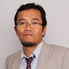
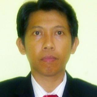
Collection Editors

Department of Mechanical Engineering, UCSI University, Malaysia
E-Mail: mahmud.iwan@proton.me
Interests: Spectroscopy; Artificial Intelligence; Robotics and control; Optimization
Department of Industrial Engineering and Enterprise Information, Tunghai University, Taiwan
E-Mail: kplin@thu.edu.tw
Interests: Project Management、Database design and application system analysis and design、Computer programming language

Department of Information Technology, Universitas Muhammadiyah Yogyakarta, Indonesia
E-Mail: riyadi@umy.ac.id
Interests: Artificial Intelligence; Signal and image processing
Topical Collection Information
Dear Colleagues,
A useful method for locating and measuring contaminants in a variety of environmental matrices is spectroscopy. It makes it possible to find toxins in the air, water, and soil quickly, including organic pollutants, heavy metals, and dangerous compounds. Atomic spectroscopy methods are employed in environmental laboratories to ascertain the content and concentration of controlled metals in environmental samples, including waste materials, waterways, soils, sludges, and air samples. A remote sensing environment is one in which the environment is studied from a distance using techniques like radar, aerial photography, and satellite imaging. Information can be obtained using remote sensors by measuring electromagnetic waves. Monitoring of forests, waterways, agricultural areas, regional and urban planning, changes in land use and cover, air and water quality, mineral prospecting, and natural and man-made dangers are a few examples of known applications for remote sensing.
By identifying invasive species, observing the consequences of introducing new wildlife, and mapping delicate ecosystems, scientists can utilise remote sensing to identify distinct plant and wildlife species in a region and follow trends and monitor changes over time. Particularly, the Atmosphere Experiment measures the quantities of water vapour and ozone. These observations are taken on-site using a solar photometer. Large-scale land use patterns can be mapped via remote sensing, and changes that take place over a specific time period can be tracked. The land can be clearly seen in the satellite photos, which also assist in identifying the areas that are suitable for different uses. Moreover, humidity sensors are within the category of environmental sensors since they measure air pressure, ambient temperature, and relative humidity for climate management in smart homes. Four-in-one gas sensors with high integration provide gas measurement to the air quality monitoring system for better health and wellbeing. In the fields of environmental mapping, mineral exploration, agriculture, forestry, geology, water and ocean management, infrastructure planning and management, and disaster mitigation and management, among others, remote sensing and geographic information systems are indispensable tools.
The fields of geo-modelling, geo-analysis, and geo-computation are under GIScience research. Through observation of the earth's surface, remote sensing information science addresses the mechanisms of human effects on the natural ecological environment system. In addition to mapping surface geology and vegetation, remote sensing can be used to evaluate glacier change, track changes in coastal areas, identify changes in permafrost landforms, track changes in land use near parks, and more. Data on environmental quality and shifting trends are the primary goals of environmental monitoring, which also aims to protect public property and life. We can assess the degree of pollution and the quality of the environment by keeping an eye on and evaluating a number of environmental indicators. One method for researching atom and molecular structures is spectroscopy. These systems emit a wide range of wavelengths, which allows for a detailed investigation of their structures, including the ground state and excited state electron configurations. Spectral sensors use a reflectance spectrum to measure and record the light that an object or scene emits or reflects. Contributions are invited from a range of disciplines and perspectives, including, but not restricted to: Advances of spectroscopy in environmental monitoring and remote sensing.
List of Interested topics include, but are not limited to, the following:
- Developments in gas monitoring using 3-D infrared remote sensing.
- Principal developments and recent advances in the field of imaging spectroscopic missions.
- The use and most current developments in remote sensing for inland water monitoring.
- The air environment with stereoscopic hyperspectral remote sensing.
- Remote sensing to track recent developments and conduct study on lakes.
- Remote sensing using unmanned aerial vehicles for environmental monitoring and the petroleum sector.
- A decade of hyperspectral terrestrial satellite observation.
- Proximate and distant sensing methods are used to monitor specific soil pollutants.
- Designing spectral libraries for hyperspectral remote sensing and wetlands land cover characterization.
- Innovative uses for remote sensing of natural vegetation and agricultural crops.
- Imaging spectroscopy for terrestrial systems using Earth observation data.
- Efficient and practical environmental monitoring through remote sensing.
- Advancements in remote sensing technology for tracking natural resources.
Collection Editors
Dr. Mahmud Iwan Solihin
Dr. Lin Guoping
Dr. Slamet Riyadi
Keywords:
- Spectroscopy
- Remote sensing
- Environment
- Imaging
- Environmental science
- Environmental Engineering


